Description:
This program creates a geodatabase feature class from a .csv file containing coordinate data. ArcPy was used for processing as well as TkInter as a graphical user interface.
Demo:
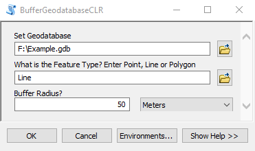
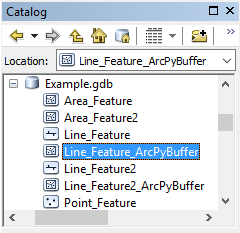
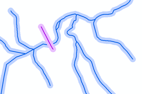
Executing: BufferCLR F:\Example.gdb Line "50 Meters"
Start Time: Wed Jun 01 16:40:49 2016
Running script BufferCLR...
Completed script BufferCLR...
Succeeded at Wed Jun 01 16:40:54 2016 (Elapsed Time: 4.33 seconds)
↓
Source Code: